Faroe Islands Drone Photography 2026 Guide
Master Faroe Islands drone photography 2026 with our guide to capturing dramatic cliffs and wild seascapes safely.
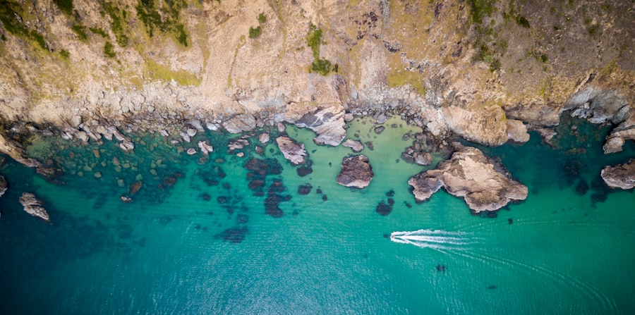
If you want to capture the raw, untamed beauty of the North Atlantic from above, this Faroe Islands drone photography 2026 guide will show you exactly how to pilot your way to breathtaking shots. Imagine emerald-green cliffs plunging thousands of feet into a churning ocean, waterfalls spilling directly into the sea, and moody mist wrapping around dramatic sea stacks. It is a drone photographer's paradise, but it is also one of the most challenging environments on Earth. As your photography coach, I am here to help you navigate these wild islands so you can bring home portfolio-worthy images safely and confidently.
Understanding the Faroe Islands Drone Landscape in 2026
The secret to mastering Faroe Islands drone photography 2026 lies in preparation and respect for local guidelines. Over the last few years, local authorities have established clear zones to protect nesting seabirds like puffins and to respect the privacy of local landowners. Before you even pack your gear, you must understand that the Faroe Islands are not a free-for-all airspace. You will need to register your drone, keep your craft under the legal altitude limits, and always ask for permission when flying near private sheep pastures or homes.
The weather here is famously unpredictable. You can experience rain, sunshine, gale-force winds, and thick fog all within a single twenty-minute window. This means your gear needs to be robust, and your flying skills must be sharp. But do not let that intimidate you! With the right techniques, those dramatic, fast-shifting weather patterns will actually help you capture incredibly moody and unique compositions that look like they belong on the cover of a travel magazine.
Essential Gear and Recommended Settings
First, let's look at what you need to pack in your gear bag. Your drone is only as good as your preparation. Because of the high winds in the North Atlantic, I highly recommend flying a drone with decent weight and powerful motors, such as the DJI Mavic series, to maintain stability in flight.
Must-Have Gear for Faroe Islands Drone Photography 2026
- A high-resolution drone: A drone with a variable aperture and a large sensor (like a 1-inch or Micro Four Thirds sensor) will help you capture the immense detail of the basalt cliffs.
- Neutral Density (ND) Filters: These act like sunglasses for your camera lens, allowing you to slow down your shutter speed to create silky water effects on the ocean.
- A sturdy landing pad: The terrain is muddy, wet, and covered in sheep droppings. A portable landing pad protects your drone's delicate camera gimbal during takeoff and landing.
- Multiple spare batteries: Cold winds drain drone batteries incredibly fast. Keep your spares warm in your inside coat pocket until the moment you fly.
Recommended Camera Settings for Dramatic Landscapes
- Image Format: RAW vs JPEG: Always shoot in RAW. While JPEG files are compressed and processed by the camera, RAW files preserve all the pure data captured by the sensor. This gives you the dynamic range needed to recover shadow details in dark cliffs and highlight details in bright waterfalls during post-processing. You can learn more about how to maximize your camera sensor's capabilities on the DPReview learning portal.
- ISO: Keep your ISO at its baseline (usually ISO 100). ISO measures the camera sensor's sensitivity to light. Keeping it low prevents unwanted digital noise (graininess) from ruining your crisp landscape shots.
- Exposure Compensation: When shooting bright white waterfalls or dark volcanic rock, your drone's auto-exposure can get confused. Use the Exposure Compensation dial to manually dial down the exposure slightly, protecting your bright highlights from blowing out.
- Aperture: If your drone has an adjustable aperture, shoot between f/4 and f/5.6. This is generally the sweet spot for maximum sharpness across the entire frame. If you want a blurry background effect, known as Bokeh, you would use a wider aperture (like f/2.8), but for sweeping landscapes, we want everything sharp from front to back.
The Golden Rule of Faroe Islands Drone Photography 2026: Never fly when wind gusts exceed 15 meters per second (about 33 mph). The wind at cliff level is often twice as strong as the wind at sea level, and your drone will have to fight incredibly hard just to return home to you.
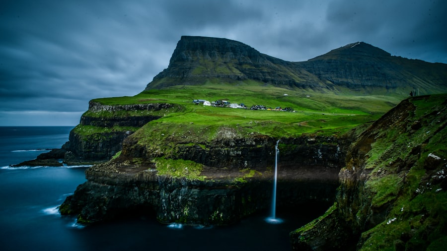
How I Saved a Failed Shot at Drangarnir: A Before & After Story
Let me share a personal story about a mistake I made so you do not have to repeat it. During my first trip, I hiked for hours to view the famous sea stacks of Drangarnir. The wind was howling, and the sky was a flat, dull grey. I launched my drone, positioned it, and took a quick snapshot.
When I looked at the screen, the image was terrible. The dark sea stacks blended completely into the dark ocean, and the sky was a blown-out, blinding white blob. It was a classic photography failure. Because I shot in JPEG and used auto-exposure, the camera tried to make the dark rocks look bright, which completely ruined the sky and made the image look flat and lifeless.
Now try this instead. To fix the shot, I landed the drone, put on an ND8 filter, and switched my camera settings to shoot in RAW. I adjusted my composition to use the Rule of Thirds, placing the sea stack on the left vertical third gridline, letting the wild waves fill the bottom two-thirds of the frame. I dialed my Exposure Compensation down to -0.7 to preserve the texture in the moody clouds.
Back in my editing studio using Adobe tutorials on dynamic range recovery, I was able to lift the shadows on the basalt rocks, bring back the deep blues of the ocean, and keep the dramatic texture of the stormy sky. The final photo looked powerful, cinematic, and full of depth, rather than a flat, grey snapshot.
Your Step-by-Step Guide to Capturing Epic Aerial Compositions
Ready to fly? Let's walk through how to capture a masterpiece step-by-step. This simple workflow will ensure you get the best out of your Faroe Islands drone photography 2026 adventure.
Step-by-Step Aerial Composition Workflow
- Scout the location safely on foot first: Before you even turn on your controller, find a safe spot to stand where you will not trip over wet grass or get too close to a cliff edge. Your safety is always more important than any photograph.
- Check your airspace and calibration: Turn on your drone and wait for it to connect to at least 12-15 satellites. Calibrate your compass if prompted. In the Faroe Islands, magnetic interference from volcanic rock can occasionally cause compass errors.
- Compose using the Rule of Thirds: Turn on the gridline overlay on your controller screen. Place key elements, like a winding mountain road, a lighthouse, or a cliff edge, along those gridlines or at their intersection points. This naturally guides the viewer's eye through your photograph.
- Look for leading lines: The Faroe Islands are full of natural leading lines. Use the dramatic lines of the cliff edges or the white foam of crashing waves to lead the viewer's eyes from the foreground directly to your main subject.
- Bracket your exposures: If the contrast between the sky and the dark cliffs is too high, use your drone's Auto Exposure Bracketing (AEB) mode. This setting takes three or five photos at different exposures in rapid succession. You can later blend them together in editing software to create a perfect High Dynamic Range (HDR) photo.
Safety, Etiquette, and Local Regulations in 2026
As we look at the landscape of Faroe Islands drone photography 2026, respecting the local environment is more critical than ever. The islands have seen a rise in tourism, which means drone pilots are under closer scrutiny. Always check local drone maps before taking off. Flying over towns like Torshavn or near airport zones like Vagar is strictly regulated.
Don't forget to watch out for birds. The Faroe Islands are home to millions of nesting seabirds. Oystercatchers and skuas are highly territorial and will actively attack your drone if you fly too close to their nests. If you hear birds screaming or see them circling your drone, bring your aircraft down immediately. Not only could you hurt a bird, but they can easily knock a lightweight drone out of the sky, ending your Faroe Islands drone photography 2026 journey in an instant.
If you want to ensure your drone meets the latest safety specifications and check if your model requires specific operator licenses, you can refer to official manufacturer guides like the Canon or DJI support hubs for remote pilot compliance.
Capture the Magic of the North Atlantic
Your photos will look absolutely spectacular if you apply these techniques. Remember to slow down, study the light, and respect the wild nature of this incredible archipelago. By mastering RAW shooting, managing your exposure compensation, and planning your compositions around the dramatic Faroese terrain, your Faroe Islands drone photography 2026 portfolio will stand out from the crowd. Pack your windbreaker, charge those batteries, keep them warm, and get ready to capture the adventure of a lifetime!
Frequently Asked Questions
Do I need a permit to fly a drone in the Faroe Islands in 2026?
Yes, all drone flights require registration and a valid permit from the Faroese Transport Authority ( Fjórbing? ) or their app, unless you're flying under EU open rules post-2026 adjustments.
What drone weight restrictions apply in the Faroe Islands?
Drones under 250g (like Mini 3/4) can fly under 'open' category restrictions, whereas heavier drones need more stringent training and maybe operational authorization.
Are there no-fly zones or restrictions in specific tourist spots like Mulafossur?
Yes, all national parks, bird cliffs, and near airports/prisons are no-fly zones, and popular cliffs active in spring have spatiotemporal bans for wildlife protection.
What is the best time of year for drone photography in the Faroe Islands in 2026?
From April to July provides 24-hour daylight, persistent fog, and photogenic green hues, while winter offers dramatic storms—but check approved lighting for twilight per regulations.
Can I upload drone images taken in the Faroe Islands commercially without a separate license?
For commercial use, you'll need an EU Part-CLA authorization or a valid Faroese national license/insurance covering commercial UAV operations.
Camille Bernard shares travel photography tips for every kind of traveller, from phone snapshots to full kits. She breaks down light, composition and timing so you come home with photos that actually capture how a place felt.
💬 Comments (0)
No comments yet. Be the first!